The session summary from the October 7 session has been posted, and the roleplay forum for next session is now open. There will be a 100 experience point bonus to anyone that participates in the roleplay forum prior to next session. The registration page for the next session will be posted tomorrow.
 There is a small WorldGate update for next session. I added one small area to the mod, and Heed has updated his PC Tools hak to make it compatible with patch 1.10. WorldGate will update both files for you. At the "versioning system" message, select "yes" to continue. If you play somewhere else that uses Heed's PC Tools, you may want to copy the current version of the hak (found in your My Documents/Neverwinter Nights 2/hak directory) and store it somewhere to swap in and out, in case the other world hasn't updated to the new version of the hak.
The session summary for the September 23 session is now up, as is the roleplay forum for the October 7 session. Since there is no game on September 30, there will be a 75 XP bonus each of the next two weeks for participation in the roleplay forum (i.e. 150 total if you post both weeks), with the first week ending Sunday at what would have been our game time.
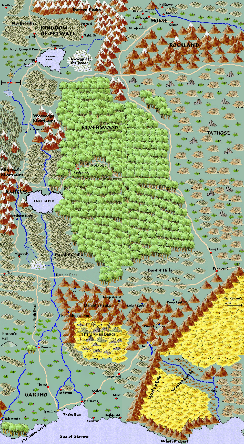
 The local area map has been updated. Yes, it sucks, but I thought it might help to give you an idea of where you are, especially since players have joined over the course of the campaign. The area depicted on the local map is a zoomed in view of an area south of Keep Mosoorlikon on the main Naeldor map (in the mountains in the southern part of the map). I've also uploaded a basic connections map, which shows how areas (exterior only) have connected so far in the campaign. There are a couple of areas that none of you have visited yet, but which at least one of you has heard mentioned. Permanent links to all of these maps can be found on the map page. If it helps, I've also uploaded a modified connection map, showing the path the party has taken since the start of the campaign. All of these maps will be clearer if you click on them to expand them to full size.
You can try to log in now.
© Copyright 2018 JD Miami Joomla Templates by JoomDev